By Summit Voice
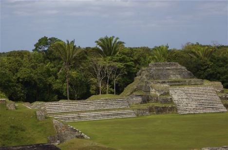
The Maya city of Altun Ha, near Belize City, thrived late in the Maya era, as trade of valuable goods shifted away from inland rivers to coastal routes. PHOTO BY BOB BERWYN.
SUMMIT COUNTY — Along with climate change, University of Illinois archaeologists say shifting trade patterns may have been a big factor in the decline of inland Maya cities about 1,000 years ago.
Other studies have suggested that even small declines in rainfall may have caused the Maya to abandon key cities.
“Our research strongly suggests that changing patterns of trade were instrumental in prompting the ‘Maya collapse,’” said Gary Feinman, curator of anthropology at The Field Museum, which collaborated with the University of Illinois at Chicago on the study.
The researchers reached their conclusions after meticulously tracing the origins of obsidian, used by the Maya as cutting instruments. Maya rulers and priests derived power from controlling access to obsidian, which could be traded for important goods or sent as gifts to foster important relationships with other Mayan leaders.
The researchers found that prior to the fall of the Maya inland centers, obsidian tended to flow along inland riverine networks. But over time, this material began to be transported through coastal trade networks instead, with a corresponding increase in coastal centers’ prominence as inland centers declined.
The new research casts doubt on the idea that climate change was the sole or principal cause of the Maya decline, Feinman said. Some Maya centers, which flourished after the collapse, were located in the driest parts of the Maya region.
Feinman said climate change, along with breakdowns in leadership, warfare, and other factors, contributed to the collapse, but the shifting exchange networks may have been a key factor.
The shift in trade might have involved more than obsidian.
“The implication is that other valuable goods important to these inland centers were also slowly being cut off,” said field researcher Mark Golitko.
Golitko led a social network analysis that graphically depicts the change in trade patterns. By tracing the origins of the obsidian and matching it against different Maya periods, the team was able to show that Classic period networks were located in inland, lowland areas along rivers, mostly in what is today the northern part of Guatemala, the Mexican state of Chiapas, the southern Yucatan, and western Belize.
However, maps bearing data from later time periods show that inland networks diminished in importance and coastal networks were thriving, in what today is the northern Yucatan and coastal Belize.
A comparison of the resulting SNA maps show that Classic period networks were located in inland, lowland areas along rivers, mostly in what is today the northern part of Guatemala, the Mexican state of Chiapas, the southern Yucatan, and western Belize. However, maps bearing data from later time periods show that inland networks diminished in importance and coastal networks were thriving, in what today is the northern Yucatan and coastal Belize.
The study did not explore the question of why the transport networks began to shift. Feinman said there may have been military animosities that made the inland, river routes less safe or easy to use, and added that during this period the seagoing transport may have become more efficient with larger canoes. He noted that scientists simply don’t have the definitive answers to some of these questions.
Source: Summitcountyvoice.com
