Interactive Belize Map (click to zoom or navigate)
Detailed Belize Map (click on image for full size)

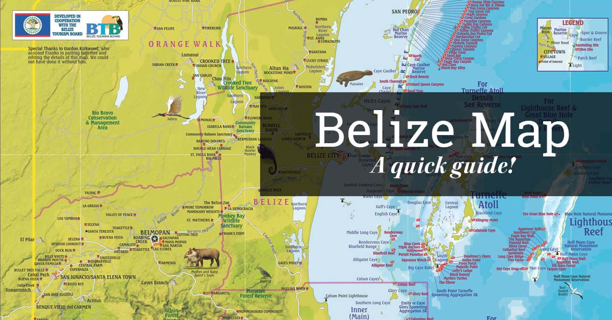
Boasting around 239 miles of beautiful Caribbean seacoast, Belize is part Caribbean part Central American. It has become a famous travel destination for adventurers, families and romantic couples alike, recently breaking the 1 million visitors mark (2016). It is also becoming known as a top retirement destination, gaining preference with Belize’s Qualified Retirement Program. Apart from our Caribbean highlights, Belize also boasts impressive Mayan ruins and sacred ceremonial caves connecting Xibalba, the Mayan underworld. Culture and food are also big highlights for travelers visiting Belize, being home to more than six cultures including the Garinagu, Maya, Mennonite, Mestizo, Asians & others. Being such a tiny country and almost unrecognizable on a map, travelers usually find themselves asking “Where is Belize?” so we decided to provide some interactive maps for you to roam and discover Belize.
Map of Belize’s Northern Districts (Orange Walk & Corozal)
Map of Belize’s Cayo District (Western Belize)
Map of Belize District (Belize City, Ambergris Caye, Caye Caulker & others)
Map of Belize’s Stann Creek District (Dangriga, Hopkins Placencia & others)
Map of Belize’s Toledo District
Didn’t find what you were looking for? Please Contact Us and let us know what we may be missing in this Belize Maps Travel Guide.