Technology Meets Archaeology in Belize: the results are amazing!
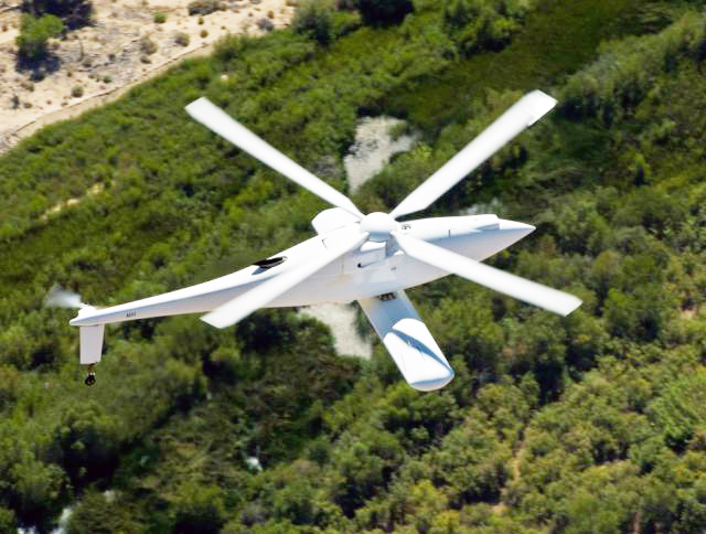
We had a nice response from our recent post about drones (Drones Join the Human Effort in Belize… July 22 2014 ) being used to protect Belize’s Great Barrier Reef, so we’re keeping our promise to update our readers on another interesting new technology being used here. Light Detection and Ranging, or LiDAR technology has been used to identify and map out ancient Maya archaeological sites in the dense jungles of Belize, and the future of this technology is promising indeed.
We love the idea of using new technology to unveil the secrets of the past, and LiDAR and other new tools are poised to open a new understanding of the ancient Maya civilisation while contributing to Belize’s eco and cultural tourism industries.
What it is
Airborne LiDAR is a scanning system that sends over 100,000 short laser pulses to the ground every second while a plane flies over it. The laser light hits the ground, and then bounces back to the aircraft. The time it takes for the light to make the return trip tells researchers the height of various points on the ground, up to differences of less than 10 centimeters (4 inches), giving us a pretty accurate picture of what’s there. Think of it as a sort of Sonar (Sound Navigation And Ranging) that uses light rather than sound echoes to describe a surface.
It also maps those scans to GPS coordinates with pinpoint accuracy.
Now, back in the old days, archaeologists had to hack through the jungle to find potential sites and then clear them before excavating. Often using anecdotal accounts by hunters, chicleros and other people working in the jungle to identify promising sites, it was – and is painstaking work with hit-and-miss results.
Now, with LiDAR fly-overs, large areas of inhospitable bush can be mapped out and patterns on the ground read to unveil ancient cities, temples, causeways, irrigation systems and other structures, with their locations recorded to within a footstep or two.
Pretty cool.
The technology has already been used for military applications (just like the drones) and in agriculture, disaster relief and other applications. In Belizean archaeology LiDAR is used to expand knowledge of places where we know there are ancient structures, while in nearby Honduras, researchers are rolling the dice and flying over vast areas in the hopes of uncovering new discoveries.
Let’s take Caracol for example: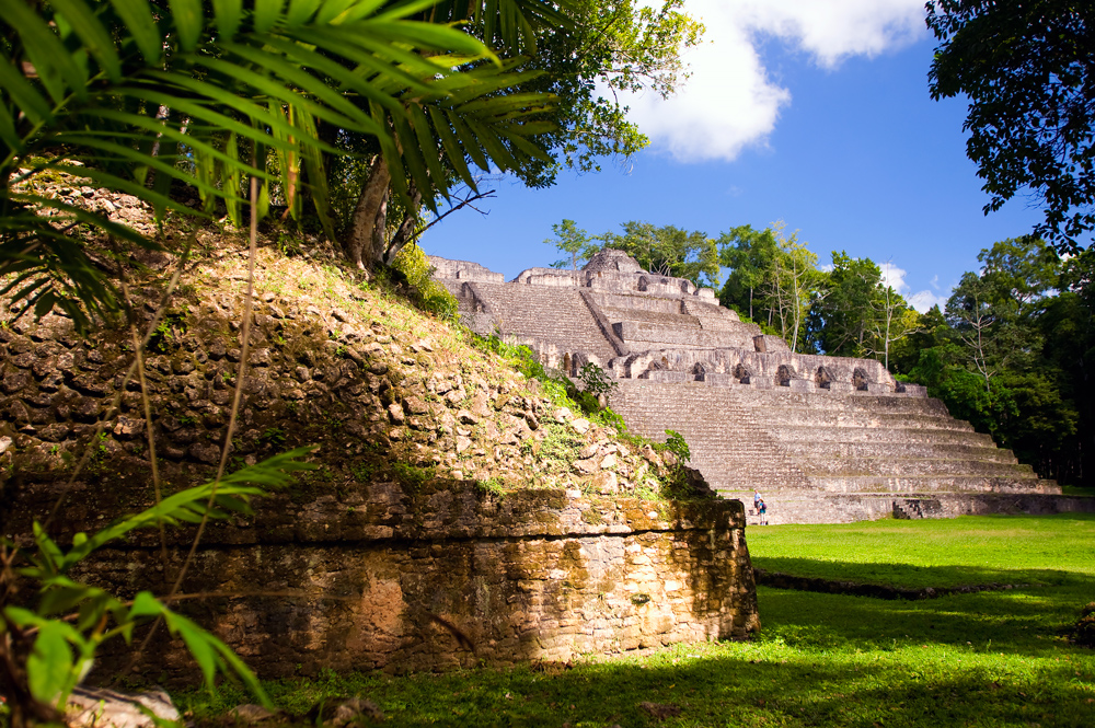

For over 25 years a multidisciplinary team of researchers have been working to uncover the mysteries of the ancient Maya metropolis of Caracol, home to what is still the largest manmade structure in Belize; Caana, or the Sky Palace.
Occupied between 600 BC and 900 AD with a population estimated at about 120,000 souls, Caracol is considered to be the crown jewel of Belizean sites. But understanding this once thriving city has not been easy due to the dense forest surrounding it. An intricate system of causeways, radiating out from the centre like spokes on a wheel connected it to other sites across the vast Vaca Plateau. Although the central plazas have been excavated, researchers believe that the urban area and suburbs extended far into the surrounding forest, which still shows signs of terrace agriculture and sophisticated irrigation.
If we’ve only scratched the surface of Caracol and its surrounds, as many researchers believe, what else lies obscured in the deep forest? The jungle canopy hides it from the air, and how much time and money will it take to hack through the jungle in a very complex sort of Easter egg hunt?
Along comes LiDAR.
A “Caracol remote-sensing project” was sponsored by the US space agency NASA to determine if LiDAR can be used to see below the forest canopy to provide images of an ancient Maya landscape in Belize. The project was even more successful than researchers hoped it would be, with just a few flyovers providing a more detailed picture of this ancient city than all the previous, painstaking on the ground research had.
The project produced a detailed view of nearly 80 square miles, more than six times the area previously mapped, showing the topography, ancient structures, causeways, and agricultural terraces. Researchers now have a much better picture of how big Caracol actually was, how it was structured, and how the ancient Maya altered their landscape to create a sustainable urban environment. Because of this, some previous ideas about how this amazing civilisation developed are being reconsidered.
When you consider how extensive and sophisticated the ancient Maya civilisation of Belize was, you have an idea of why people are so excited about the potential of LiDAR.
We’re following LiDAR projects in Belize, and will keep you updated. Researchers have only scratched the surface of Belize’s vast ancient Maya civilisation, and who knows what cultural riches are still waiting to be discovered in Belize immense, pristine rainforests? It’s exciting work that is constantly uncovering fascinating discoveries. When you consider that the now famous Actun Tunichil Muknal cave with its treasure trove of riches was a relatively recently discovery, you understand our excitement.
And now there’s talk of equipping drones with LiDAR to make it even cheaper and more practical to map out the entire Mundo Maya, or ancient Maya World.
Stay tuned…